1. Qassiarsuk 113,42 km2 (43,7 mi2)
There are 16 farms, where 10 of these are within the heritage area. 39 Norse ruin sites are registered in the area and 5 Inuit ruin sites (2020). There are reconstructions of Tjodhildurs church and a long house.
A statue of Leif the Lucky stands above the settlement pointing west, towards Vinland.
Every year you can participate in Leif the Lucky Marathon, going between several sheep farms.
There is more than 100 km (62 miles) of dirt road, giving plenty of possibilities for hiking in a fantastic scenery.
All of the inhabited area stretches from Narsarsuaq to Sillisit and is about 265 km2 (102 mi2)
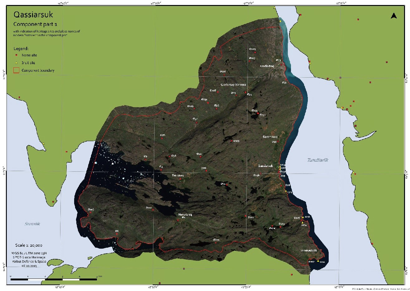
The key site in component area 1 is ruin site E29
Eric the Red settled in Brattahlid, the most suitable area for farming in Greenland. The farm is situated in the flattest area in the eastern settlement; he called it Brattahlid (a steep mountain slope) – quite a misleading name. The archaeological evidence is quite overwhelming though. Here we see a large farm, close to the fiord; many small farms, large farms and stables in a relatively large land area; a small church dated to around year 1000 and placed agreeable 100 m (300 feet) away from the farm; the large church is built in the beginning of the 1300’s.
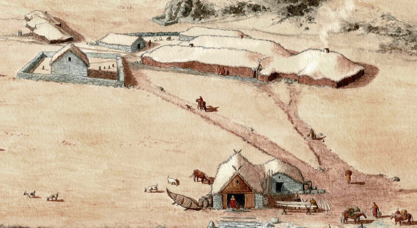
Detail from illustration by Konrad Nuka Godtfredsen
Today here is a Greenlandic settlement with a main income from farming.
2. Igaliku / Gardar - 82,8 km2 (31,7 mi2)
Igaliku is today a small farming based settlement with many summer houses. There are 4 modern farms (2020). The modern agriculture was introduced in Igaliku in the late 1700’s. There are 53 buildings registered in the component, the earliest of which are from the 1800’s. You can see the whole development in house building, where the red Igaliku Sand Stone was very well used.
Four Inuit ruin sites have been registered within the component, together with several burial sites; these show Thule culture burial practices, Christian burials and a transform burial practice from between the two. 19 Norse ruin sites are registered in Component area two.
This component area has historically the largest most fertile hay fields in Greenland.
.JPG?ver=2020-02-26-124250-883)
The sheep farms Uummannartiivaraq and Tatsip Kitaa, component area 2, photo Arnaq Bjerge KUJATAA
There have been found comprehensive irrigation systems, a cathedral, a complete settling pattern revolving the bishop’s manor - The western most diocese in medieval Christianity.
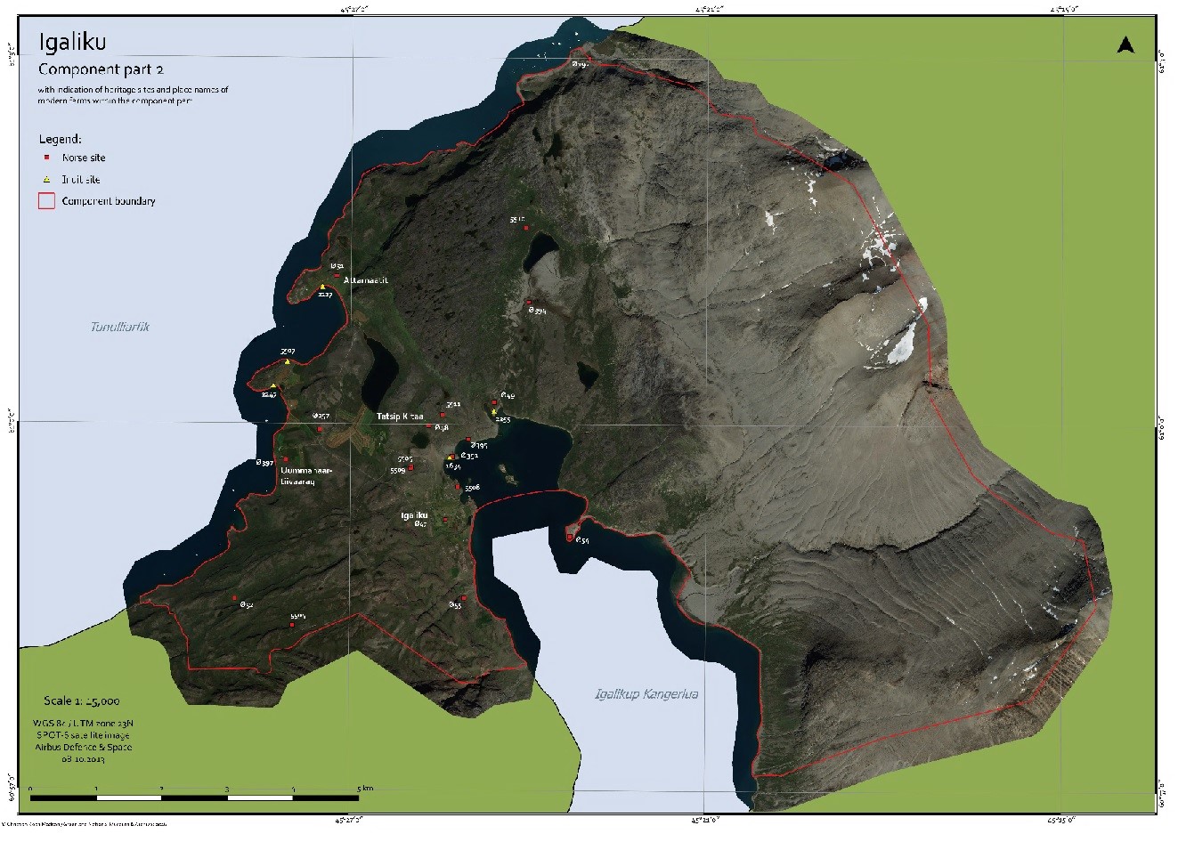
The key site of component area 2 is ruin group E47
The sagas describe a very political process in the first half of the 1100’s, where Greenlandic Norse wished to become a catholic diocese.
The sagas describe a very political process in the first half of the 1100’s. Here the Norse Greenlanders express a wish for becoming a diocese in the catholic world.
Fights between Norse Greenlanders and Norwegian Vikings have been described very well within this area.
The cathedral, which was built in 1129-30, must have been built as a stave church, as they built churches in Norway and Faroe Islands in th 1100’s. The stave church was built inside a thick stonewall, to protect it from the frequent, strong storms.
The bishop had very large living quarters, whereof one of the rooms was built has a fiest hall; there were byres with room for 100 cattle, a smithy and a storage house for tithe (church taxes).
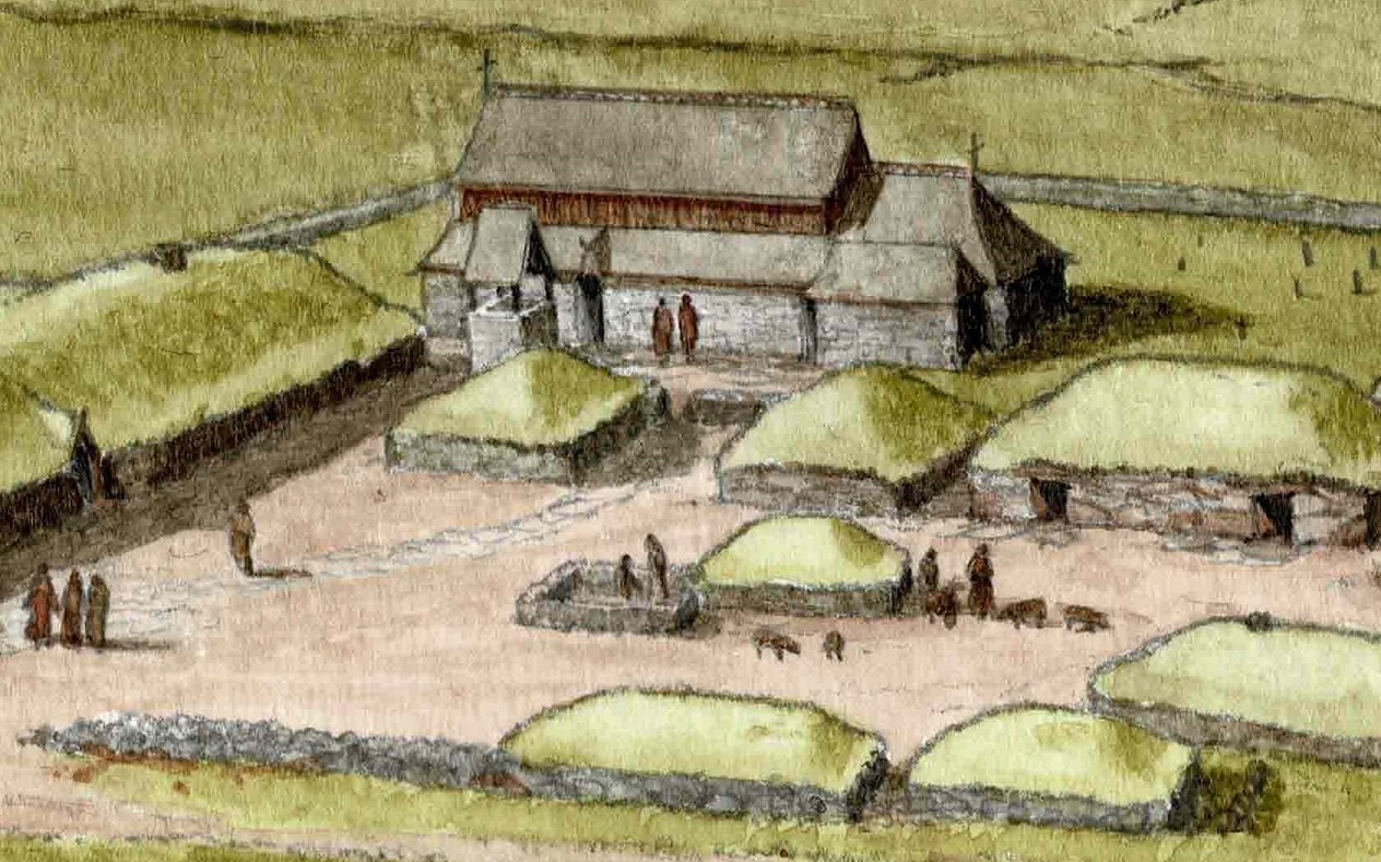
Detail from illustration by Konrad Nuka Godtfredsen
3. Sissarluttoq / Dalr - 3.39 km² (1,2 mi2)
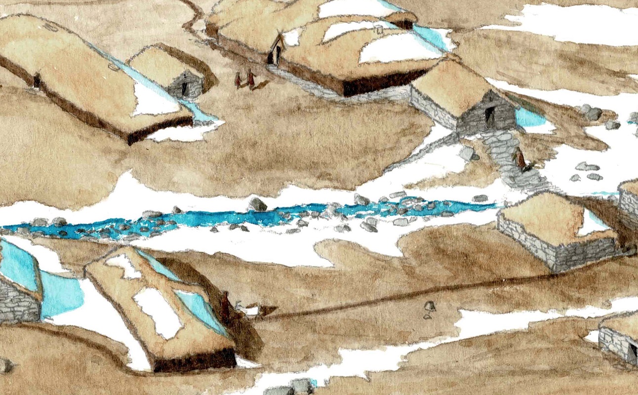
The Greenlandic name means ’bad landing spot’ and is placed on a relatively steap piece of land, with good conditions for hay fields. It is the smallest of the five component areas and consist of a single large Norse farm, very well preserved; there are two ruin sites in the component.
The ruin site is situated on a relatively high plateau; there are more than 50 ruins, both for living and farming purposes (centralized farm, pens, stables and storage houses).
There are no inuit ruins or modern farms here. Farmers still use the places and fences show they use it for gathering sheep; there are two huts from the 1970’s, used for accommodation when they gather sheep.
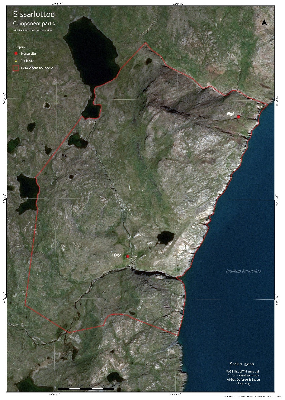
The key site in component area 3 is E59
The component area is part of the world heritage site because it represent a complete Norse farm. The ruins are relatively untouched because of the difficult access.
The place is not yet excavated by archaeologists, so we cannot tell so much detailed about the place.
There is no doubt that the people of Dalr liked building drystone buildings. Far away from other farms, this represents a complete Norse farm with all what is needed to have agriculture.
Detail from illustration by Konrad Nuka Godtfredsen
4. Tasikuluulik / Vatnahverfi - 75.42 km² (28,6 mi2)
This component area is on the south side of Igaliku Fiord (Einars Fiord). The Norse name is Vatnahverfi, which means ’the lake district’ and so does the Greenlandic name.
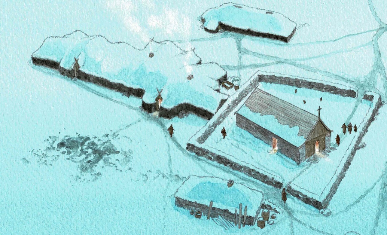
There are 6 modern farms in the area (2020). In this component area we find Undir Höfde (Igaliku Kujalleq), a large farm with it’s own church. The landscape is very dynamic, partially shaped by the deflation (several ruins can be hidden under the sand dunes).
Further west in the component area there are many lakes and low shrub vegetation surrounding small and/or medium sized ruin sites.
Andreas Egede was the first to start farming in Igaliku Kujalleq in 1934; the other farms in the inland on this peninsula were started in the 1980’s.
The peninsula is archaeologically best documented, and excavations started already in the mid 1800’s.
There has not yet been registered any Thule Inuit ruin sites, but 19 Norse sites and can be seen in the area. A protected bulding from 1946 can be seen within the component.
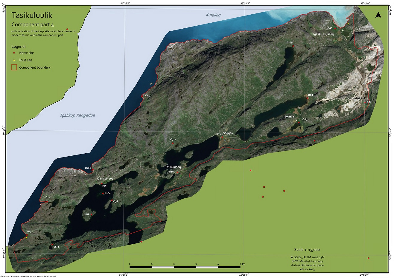
The key site in component area 4 is Norse ruin site E66
The northern most church on the peninsula has been very rich and had a large perish. The church bulding is unique because of three stone walls and a western wall, that has been made of wood. The centralized farm has been buried in sand for centuries, until it was excavated in the late 1800’s.
The place was probably the last habited Norse farm on the peninsula.
Farms on the peninsula show a decrease in domesticated plants already in the mid 1200’s. The first sign of decay in Norse activities in Greenland.
Detail from illustration by Konrad Nuka Godtfredsen
5. Qaqortukulooq / Hvalsey - 44,5km² (28,2 mi2)
This component area is placed in the area between outer archipelago and inner Fiord. 11 Norse ruin sites and 2 Inuit ruin sites are registered here.
The area has good pastures but is not ideal for hay fields; the Norse farms were smaller, compared to the inner fiord farms.
Hvalsey Church ruin – the most iconic ruin in the world heritage area - is found in this component area.
The small farms surrounding Hvalsey were owned by the main farm and have given the manor farm it’s high status. There is no longer a modern farm near Hvalsey, but the grazing areas are still in use.
The sheep breeding station, Upernaviarsuk, is found in the component area and the Greenland government has it’s farmers education here.
This is where the modern agriculture started in the late 1700’s; Anders Olsen and his wife Tuperna started farming here before moving to Igaliku. We see the structures of the houses that started the modern farming in Greenland.
There are several Inuit burial sites within the component area.
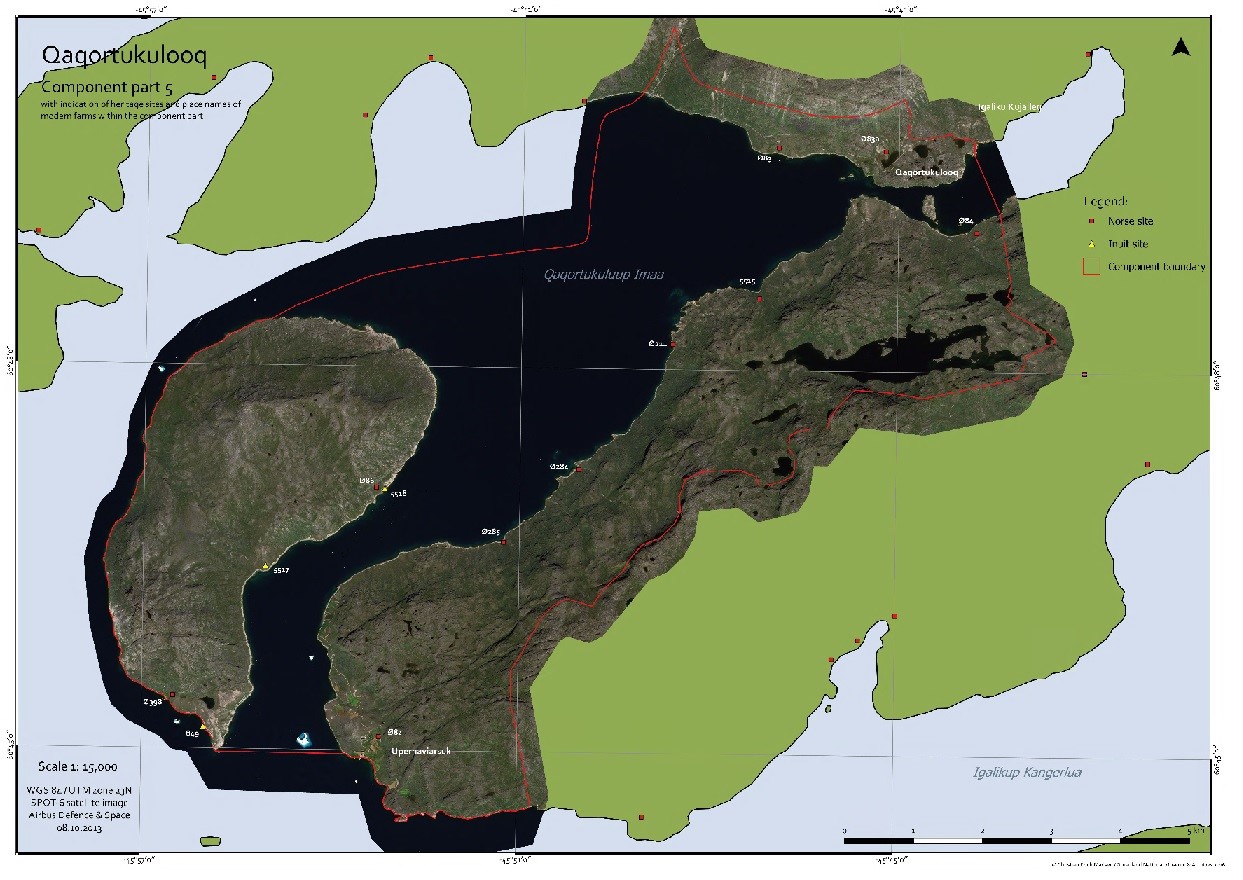
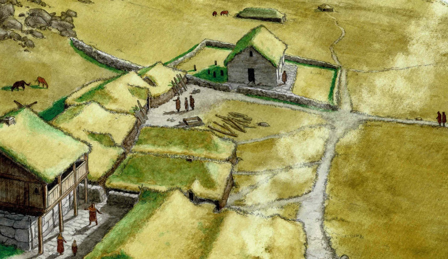
The key site in component area 5 is E83
The best preserved Norse ruin in Greenland today. Here we see the manor farm with byres, barns and storage houses. A fiest hall shows that here lived a wealthy an.
Inside the church a grave has been excavated; nothing indicates who he was – but we are quite sure that he was a priest.
The church bell was inside the western window of the church. It had a sattle roof with turf. Behind the church, inside the church yard, the only erect grave stones of the Eastern settlement have been found.
Detail from illustration by Konrad Nuka Godtfredsen
Hvalsey had horizontal shieling, meaning that the summer pastures were further out in the fiord, instead of up on the mountain.
The people from the perish came on horseback to go to church services. They ‘parked’ their horses in the horse ring (ruin 14) while they were in church.
The fiest hall was in two floors, the basement was used for storage of tithe. Ruins 1 and 12 were stables built together under same roof as the barns.
The church is built in the early 1300’s. This is the place of the last documented Norse activity in Greenland;
Sigríður Björnsdóttir and Þorsteinn Ólafsson.
According to the sagas Thorsteinn went to Norway, where he spent the winter. On his way back to Iceland in 1406 he was blown out of course and came to the Eastern settlement.
Sigridur and Thorsteinn were married in Hvalsey Church – the last testimony of the Norse in Greenland.